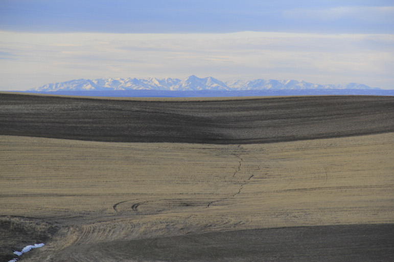
The Crazy Mountains came in and out of view at least a dozen times on a long drive south of Billings on Thursday. Click on the arrow at top right for more photos.
I don't necessarily want to waste gas, but when they're practically giving it away, as at this station in Lockwood, a drive in the country does sound more alluring.
One nice thing about being your own boss is that you get all the plum assignments.
Thursday morning, with temperatures hovering around 60 and the sky mostly blue, I sent myself on a good long drive, with instructions to take plenty of photos.
I had a particular drive in mind, based on something I’d seen in my Delorme Atlas and Gazetteer of Montana. That something was Cormier Road, a zigzaggy route that runs southwest from Blue Creek Road between Duck Creek and Pryor roads.
For its roughly 12-mile length, it marks the border of the Crow Indian Reservation. Though I’d been down Duck Creek and Pryor roads many times, I wasn’t even aware of Cormier Road’s existence until recently.
And so I went, not exactly by the most direct route. Rather than heading straight down Blue Creek Road, I drove out to Lockwood and bore south on Highway 87 East, planning to go from there to Pryor Road and up Blue Creek Road to Cormier.
A few miles south of Lockwood, Highway 87 started climbing and winding up a short pass through the piney hills. Halfway up I noticed, off to my right, to the west, the white peaks of the Crazy Mountains looming on the horizon. The Crazies would disappear and reappear repeatedly during the drive.
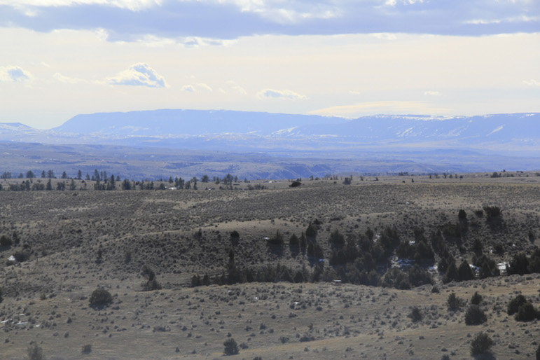
Once you reach the top of that diminutive pass, the long, low profile of the Pryor Mountains suddenly comes into view at the west edge of a big, wide-open valley of deeply seamed ridges and coulees. Also visible from the top of the pass was a ridgeline of bare, fire-blackened trees.
The trees reminded me that I hadn’t driven this far south on Highway 87 since covering a fast-moving wildfire six or seven years ago. I think I might have seen that line of trees when it was on fire.
The road kept dropping beyond that point, winding past cliffs of sandstone rimrocks, to my mind one of the prettiest sights in the world. I was soon on Pryor Road, a narrow, no-shoulder passage that can be dangerous, especially at night. As I understand it, it was formerly a railroad bed, on top of which someone once laid some asphalt and called it a road.
But for a Sunday drive on a sunny Thursday afternoon, there’s nothing wrong with it at all. At one point, consulting my Delorme, I noticed that if you kept going on Pryor Road past Blue Creek Road for five miles or so, you’d hit Thornton Road, which would take you back to Blue Creek Road near its intersection with Cormier Road.
It looked like an attractive detour, but unfortunately I could not find Thornton Road and didn’t turn back until I had gone much, much farther than was reasonable. But what’s the hurry on this sort of outing? I was treated to beautiful views of Pryor Creek, and got to watch a big spotted horse—a paint?—wallowing furiously in a dusty field like a dog on a rug.
I didn’t see Thornton Road on the way back either, but once I turned onto Blue Creek Road and drove uphill, there at the top of the hill was Thornton Road, clearly marked on this end but also posted as private property, no trespassing.
I reached Cormier Road a few miles later and there were no signs warning off trespassers, but there were, in the space of less than half a mile, four “No fireworks” signs. I’m guessing the nearest rancher had had some bad experiences with city slickers heading out into the county with their Fourth of July ordnance.
Cormier Road is gravel, but approximately twice as wide as Pryor Road. It sits atop a vast high bench of hay fields and pastureland, and of itself is not terribly picturesque. But you never know what you’ll run into.
Ed Kemmick/Last Best News
These crows flew up and away as I approached the site where they’d been picking on the bones of a dead cow. A rib cage is just visible at the bottom of the frame. There are more photos of the grisly scene in the gallery above.
I hadn’t been on Cormier Road long when a flash of movement caught my attention off to the east. I glanced over and there on the edge of a stubble field, several hundred yards away, were two bald eagles pirouetting through the sky, with three more bald eagles on the ground below them, along with seven or eight big crows.
I was too far away to get a decent photo, so I got out and walked over to see what the attraction was. The eagles were gone long before I arrived, but a gang of crows didn’t fly up from the cow carcass they were feeding on until I got quite close. There were the remains of at least three cows on the side of a small hill, one with just enough meat left on its bones to justify the avian picnic, the others long dead and picked clean.
I saw nothing else of that nature, but what makes that road worth the drive is its sense of wide-openness, and the sense that you could be a few hundred miles from Billings, rather than 15 miles as the crow flies from downtown.
At one point, coming up on big rounded buttes of brown grass, with snow-choked ravines running down their flanks, I had the momentary sensation of being up on the steppe-like prairie near the top of the Beartooth Pass.
And there were the Crazies again, looking bluish-white in the distance, with the Beartooths to the south and the Big Snowies to the northeast. From one spot I thought I could even see the Castle Mountains north of the Crazies.
In addition to those ranges that come in and out of view, the whole time you’re on Cormier Road the Pryor Mountains are visible just beyond the big plain south of the road. I’ve never seen the Pryors from such a perspective, so close but from an elevated vantage point.
Cormier Road eventually dead-ended and turned into Stratford Hill Road, which runs straight north for a few miles. This road was even more surprising, somehow, because it seemed even more remote. It is a narrow dirt road that curves through a broad valley before climbing a steep hill, Stratford, no doubt, from the top of which there is another grand view.
Stratford Hill Road soon turns into Hillcrest, which would have taken me past the landfill and back to Blue Creek Road, but I was not quite ready to give up the gravel yet, so I detoured west on Keller Road and then again on Fritz Road, which came out on Duck Creek Road not far from the Yellowstone River.
The jaunt covered about 85 miles and took me nearly three hours, which may give you some idea of how slowly I drove, and how often I stopped for photographs, or just to take in the view.