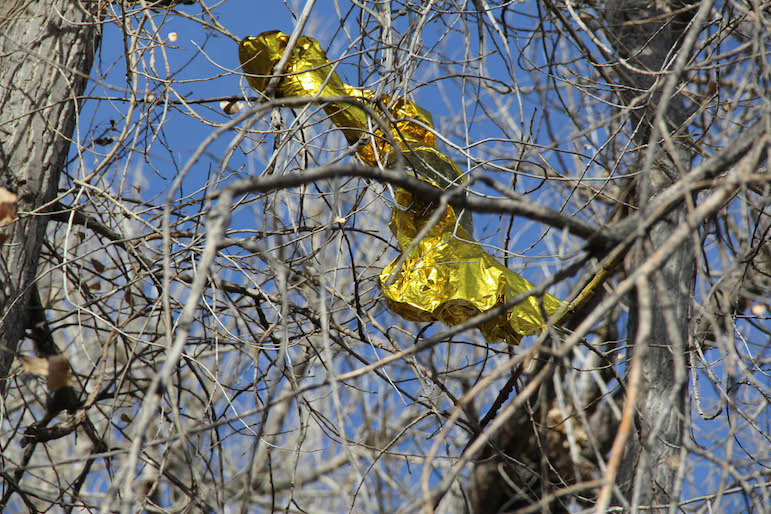
A punctured balloon, or something like it, came to rest in a tree at Clarks Crossing.
In the early 1990s, when I was new to Billings, I spent a lot of time at Riverfront Park.
I mostly went down there to bomb around on my six-speed bicycle, which wasn’t quite a mountain bike but was tough enough for those soft trails. At the east end of the park, downstream, the last segment of the old Washington Street Bridge was still standing, and you could dive off the iron trestle into what was then a slow channel of the Yellowstone River.
Over the years, a lot of other places opened up along and near the river. Across South Billings Boulevard from Riverfront, there was an island that became accessible after the Yellowstone River Parks Association built a bridge to it, cut some trails and christened it Norm Schoenthal Island.
Norm’s Island, as it is usually called, became my go-to destination, especially after a dog joined our family. The YRPA also did a lot to make Two Moon Park more attractive, building trails and later declaring war on the invasive Russian olive trees.
Other parks were developed or acquired, too, including Mystic Park, just upstream of the city water plant, Coulson Park, just downstream of the old coal plant, and then the Four Dances Natural Area, across the river from Coulson.
The more I started using all these other parks, the less I visited Riverfront, until I realized a few weeks ago that I hadn’t been there in a couple of years. So I went, accompanied by my dog, Xavi, who looks like a miniature Lab with dreads, and we had so much fun that we returned twice more in short order.
Our jaunts also made me want to tell people about the park — the people who’ve never been there and the people like me who might once have been familiar with it but have drifted away toward the other river parks.
And there are many people, I’m guessing, who have been to Riverfront but have never ventured far from the picnic shelters around Lake Josephine, which is right inside the main entrance to the park, off South Billings Boulevard just north of the river.
Riverfront’s main attraction is that it is huge. Two Moon Park encompasses about 90 acres and Norm’s Island about 80. Riverfront Park, as far as I can tell, has 600 acres. Even if that includes Norm’s Island, which is considered part of the Riverfront Park complex, Riverfront proper is still big, more than 500 acres.
The first big chunk of it — the developed areas around Lake Josephine — looks like an urban park, but as soon as you go by foot or bicycle away from the lake, things get wild quickly.
The best thing about Riverfront is that it’s easy to get lost there. Not the kind of lost where you need to be rescued, but lost as in being able to follow countless faint trails off the main paths, ending up in unfamiliar surroundings no matter how often you visit.
Ed Kemmick/Last Best News
Layered leaves at Riverfront.
It helps that the park itself is always changing. The trails right along the river are most subject to change, of course, and subject to outright destruction. Almost every spring melt carries away large chunks of riverbank, so new trails are always being built and old ones rerouted around dead-ends.
Most of the trails at Riverfront have been completely underwater at least a few times in the past two decades, and dry channels and boggy sloughs turn into miniature rivers when heavy snowmelt is flowing, further rearranging the trail system.
Many of the trails are simply pioneered by park visitors, usually by those on mountain bikes, sometimes because they’re in search of adventure but also because when a dead tree falls across the trail, it’s often easier to branch off and make a new trail around it — and if the going is good to keep on traveling in that new direction.
In most of Riverfront, once you leave the trail you enter into dense thickets of trees, bushes, high grass and brambles almost immediately. Somewhere in the vicinity of Cochran Pond, the body of water connected to Lake Josephine by a small channel, there is a plaque marking the spot where, supposedly, a steamboat made it farthest up the Yellowstone River.
I used to know where that plaque was. On our recent visits, Xavi and I could not find it, but in tramping through waist-high brambles we did manage to collect innumerable burrs. They came off my clothes easily enough, but Xavi’s dreadlocked legs and extravagant tail were another matter.
Even worse than burrs, if you’re a dog owner, are all the patches of marshy ground and the aforementioned sloughs. It takes a long dry spell to make those areas solid. If they are at all wet, your shoes and the lower ends of your pants will be covered in stinky black mud, as will your dog. Dogs love it; the people waiting for you at home generally don’t.
Anyway, my advice about Riverfront is: just go. It’s cold now, but at least it’s not wet. In the spring it’s generally too wet and in the summer it’s too buggy. Late fall — which is when we were there — and winter are best.
But there’s more. I knew, in a vaguely remembered way, that another chunk of river bottom adjacent to the downstream end of Riverfront Park had been added to the complex in recent years. An internet search even reminded me that I had written one of the early stories about the project.
Ed Kemmick/Last Best News
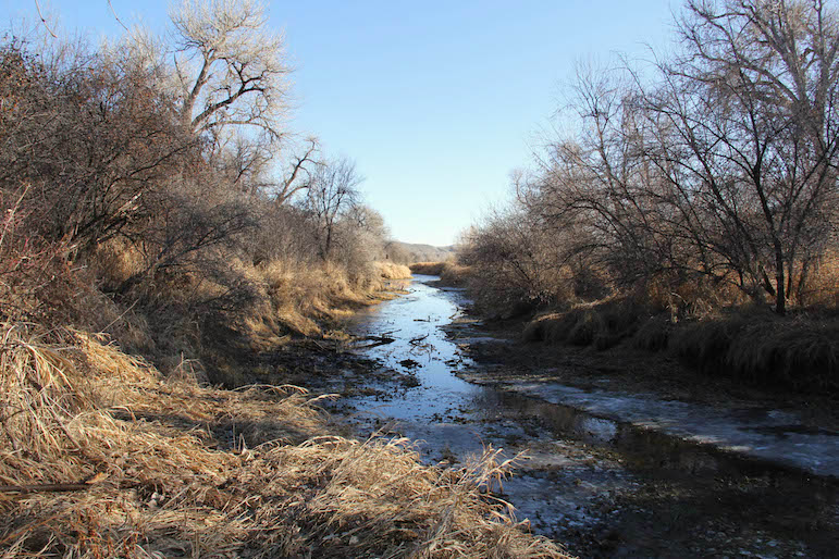
At Clarks Crossing, a narrow trail winds through the river bottom.
But it wasn’t until these recent outings that I actually explored the 71-acre addition formally known as Clarks Crossing. Long ago, when the last remnant of the Washington Street Bridge was still standing, dry land extended downstream from the bridge, far out into what was then a side channel of the river.
I used to wander around there, but you couldn’t venture very far inland from the bank because it was all private, fenced property. Most of that land has long since been washed away, but with the creation of Clarks Crossing, there is a whole new patch of river bottom as large as Norm’s Island just waiting to be explored.
Clarks Crossing sits a bit lower than Riverfront Park and gets flooded more often, and it is braided with dry beds that probably fill with water in the spring. One result is that Clarks Crossing is much more open than Riverfront proper and a bit more open even than Norm’s Island.
There are few Russian olive trees and not many thickets, just broad expanses of matted grass and scattered stands of immense cottonwood trees. It is a beautiful, peaceful stretch of our magnificent river.
It is still basically a city park, however, so you can almost always hear the sound of traffic on I-90 and the occasional buzz and whine of dirt bikes at the motorcycle club across the river. But nearly as often you hear the honking of Canada geese circling above your head or coming in for a landing on the open water.
And it is the Yellowstone River. You can always expect to come across some rusted, jagged fragment of Detroit steel, as well as beer cans and bottles and other castoffs of what we like to think of as civilization.
But those are minor distractions. Mostly, we should all be thankful to live on the longest undammed river in the Lower 48, and to live in place that has managed to make so many remarkable stretches of it open to all.
Getting there: If you don’t want to walk or bike from the main entrance to Riverfront Park downstream to Clarks Crossing, there is another entrance off South Frontage Road.
That entrance is 1.2 miles east of South Billings Boulevard and 0.8 miles west of the Sugar Avenue overpass. Small “Clarks Crossing Trailhead” signs are posted on either side of the entrance. There used to be a parking lot there, but now there is a warehouse of some kind, and apparently you’re supposed to park on the shoulder of South Frontage Road and walk in.
You’ll be following the old Washington Street, with bits of crumbling pavement here and there. When the road dead-ends at the river, next to a rock cairn bearing a “Dutcher Trail” plaque, Clarks Crossing is to your left, downstream, with Riverfront Park upstream.